


Back to products
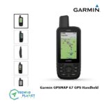
Garmin GPSMAP® 67 Handheld GPS
Original price was: ৳ 90,000.00.৳ 85,000.00Current price is: ৳ 85,000.00.
Garmin GPSMAP 67i GPS Handheld with inReach Satellite Technology
| Brand | Garmin |
| Model | GarminGPSMAP® 67i |
| Origin | USA |
| Availability | Pre-Order |
Description
GO EXPLORE THE OUTDOORS — AND STAY CONNECTED TO HOME
Make more time for adventure with this premium, rugged GPS handheld and satellite communicator. Get inReach® technology that enables two-way messaging, interactive SOS alerts and location sharing1 plus mapping to keep you on course.
|
Travel longer with up to 165 hours of battery life in tracking mode and up to 425 hours in expedition mode. |
Two-way messaging lets you share the moment with the ones who matter. |
Let your loved ones follow your adventure with location tracking. | Have an emergency? Trigger an interactive SOS alert anytime, globally. |
Track your position in challenging conditions with multi-band technology and expanded GNSS support. |


| General | |
| LENS MATERIAL | chemically strengthened glass |
| DIMENSION | 2.5” x 6.4” x 1.4” (6.2 x 16.3 x 3.5 cm) |
| WEIGHT | 8.1 oz (230 g) with batteries |
| WATERPROOF | IPX7 |
| MIL-STD-810 | yes (thermal, shock, water); bare unit only |
| DISPLAY TYPE | transflective color TFT |
| DISPLAY SIZE | 1.5″W x 2.5″H (3.8 x 6.3 cm); 3″ diag (7.6 cm) |
| DISPLAY RESOLUTION | 240 x 400 pixels |
| BATTERY TYPE | rechargeable, internal lithium-ion |
| BATTERY LIFE | Up to 165 hours with inReach® enabled with 10 minute tracking Up to 180 hours in GPS Mode Up to 425 hours in Expedition mode with inReach enabled Up to 840 hours in Expedition mode |
| MEMORY/HISTORY | 16 GB (user space varies based on included mapping) |
| INTERFACE | USB-C |
| Maps & Memory | |
| PRELOADED MAPS | yes (TopoActive, routable) |
| ABILITY TO ADD MAPS | yes |
| BASEMAP | yes |
| AUTOMATIC ROUTING (TURN BY TURN ROUTING ON ROADS) FOR OUTDOOR ACTIVITIES | |
| MAP SEGMENTS | 15,000 |
| SATELLITE IMAGERY | yes (direct to device) |
| INCLUDES DETAILED HYDROGRAPHIC FEATURES (COASTLINES, LAKE/RIVER SHORELINES, WETLANDS AND PERENNIAL AND SEASONAL STREAMS) | yes |
| INCLUDES SEARCHABLE POINTS OF INTERESTS (PARKS, CAMPGROUNDS, SCENIC LOOKOUTS AND PICNIC SITES) | yes |
| DISPLAYS NATIONAL, STATE AND LOCAL PARKS, FORESTS, AND WILDERNESS AREAS | yes |
| EXTERNAL MEMORY STORAGE | yes (32 GB max microSD™ card) |
| WAYPOINTS/FAVORITES/LOCATIONS | 10,000 |
| COURSES | 250, 200 course points per course |
| TRACKS | 250 |
| NAVIGATION TRACK LOG | 20,000 points, 250 saved gpx tracks, 300 saved fit activities |
| ACTIVITIES | |
| NAVIGATION ROUTES | 250, 250 points per route; 50 points auto routing |
| Sensors | |
| GPS | Yes |
| GALILEO | yes |
| QZSS | yes |
| BEIDOU | yes |
| IRNSS | yes |
| BAROMETRIC ALTIMETER | yes |
| COMPASS | Yes (tilt-compensated 3-axis) |
| HIGH-SENSITIVITY RECEIVER | yes |
| GPS COMPASS (WHILE MOVING) | yes |
| MULTI-BAND FREQUENCY SUPPORT | yes |
| Daily Smart Features | |
| CONNECT IQ™ (DOWNLOADABLE WATCH FACES, DATA FIELDS, WIDGETS AND APPS) | yes |
| SMART NOTIFICATIONS ON HANDHELD | Yes |
| WEATHER FORECASTS | Yes |
| ACTIVE WEATHER | Yes |
| VIRB® REMOTE | Yes |
| PAIRS WITH GARMIN CONNECT™ MOBILE | yes |
| Safety and Tracking Features | |
| LIVETRACK | Yes |
| Tactical Features | |
| XERO™ LOCATIONS | Yes |
| Outdoor Recreation | |
| POINT-TO-POINT NAVIGATION | Yes |
| TRACBACK® | yes |
| AREA CALCULATION | Yes |
| FISH FORECAST | Yes |
| SUN AND MOON INFORMATION | Yes |
| GEOCACHING-FRIENDLY | yes (Geocache Live) |
| CUSTOM MAPS COMPATIBLE | yes (500 custom map tiles) |
| PICTURE VIEWER | Yes |
| LED BEACON FLASHLIGHT | Yes |
| inReach® Features | |
| INTERACTIVE SOS | Yes |
| INREACH WEATHER | Yes |
| SEND AND RECEIVE TEXT MESSAGES TO SMS AND EMAIL | Yes |
| SEND AND RECEIVE TEXT MESSAGES TO OTHER INREACH DEVICE | Yes |
| SEND AND RECEIVE GROUP MESSAGES | Yes |
| EXCHANGE LOCATIONS WITH OTHER INREACH DEVICE | yes |
| MAPSHARE COMPATIBLE WITH TRACKING | Yes |
| VIRTUAL KEYBOARD FOR CUSTOM MESSAGING | Yes |
| SEND WAYPOINTS TO MAPSHARE DURING TRIP | Yes |
| SEND ROUTE SELECTION TO MAPSHARE DURING TRIP | Yes |
| Outdoor Applications | |
| COMPATIBLE WITH GARMIN EXPLORE™ APP | Yes |
| GARMIN EXPLORE WEBSITE COMPATIBLE | Yes |
| COMPATIBLE WITH GARMIN MESSENGER APP | Yes |
| SMART SWITCHING BETWEEN WI-FI, CELLULAR AND SATELLITE WITH GARMIN MESSENGER APP | Yes |
| Connections | |
| CONNECTIONS WIRELESS CONNECTIVITY | yes (Wi-Fi®, BLUETOOTH®, ANT+®) |
| in the box | GPSMAP 67i
Type A to Type C USB cable Carabiner clip Documentation |
Reviews (1)


Nahid islam –
Wonderful technology gpsmap 67i inreach series