


Sold out

Back to products

Garmin Handheld GPS Oregon® 750
Original price was: ৳ 75,000.00.৳ 70,000.00Current price is: ৳ 70,000.00.
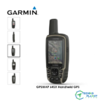
GARMIN HANDHELD GPSMAP® 78s
Brand: Garmin
Model: GPSMAP 78s
Origin: USA
Availability: Discontinue
Description
General |
|
| DIMENSION | 2.6″ x 6.0″ x 1.2″ (6.6 x 15.2 x 3.0 cm) |
| DISPLAY SIZE | 1.43″ x 2.15″ (3.6 x 5.5 cm); 2.6″ diag (6.6 cm) |
| DISPLAY RESOLUTION | 160 x 240 pixels |
| DISPLAY TYPE | transflective, 65-K color TFT |
| WEIGHT | 7.7 oz (218.3 g) with batteries |
| WATERPROOF | IPX7 |
| BATTERY TYPE | 2 AA batteries (not included); NiMH or Lithium recommended |
| BATTERY LIFE | 20 hours |
| MEMORY/HISTORY | 1.7 GB |
Maps & Memory |
|
| ABILITY TO ADD MAPS | yes |
| BASEMAP | yes |
| AUTOMATIC ROUTING (TURN BY TURN ROUTING ON ROADS) FOR OUTDOOR ACTIVITIES | Yes (with optional mapping for detailed roads) |
| EXTERNAL MEMORY STORAGE | microSD™ card (not included) |
| WAYPOINTS/FAVORITES/LOCATIONS | 2000 |
| NAVIGATION TRACK LOG | 10,000 points, 200 saved tracks |
| NAVIGATION ROUTES | 200 |
Sensors |
|
| HIGH-SENSITIVITY RECEIVER | yes |
| BAROMETRIC ALTIMETER | yes |
| COMPASS | Yes (tilt-compensated 3-axis) |
Outdoor Recreation |
|
| AREA CALCULATION | yes |
| HUNT/FISH CALENDAR | yes |
| SUN AND MOON INFORMATION | yes |
| GEOCACHING-FRIENDLY | Yes (Paperless) |
| CUSTOM MAPS COMPATIBLE | yes |
| in the box | · GPSMAP 78s
· Wrist strap · USB cable · Quickstart Guide |
| PICTURE VIEWER | yes |
Reviews (0)


Reviews
There are no reviews yet.